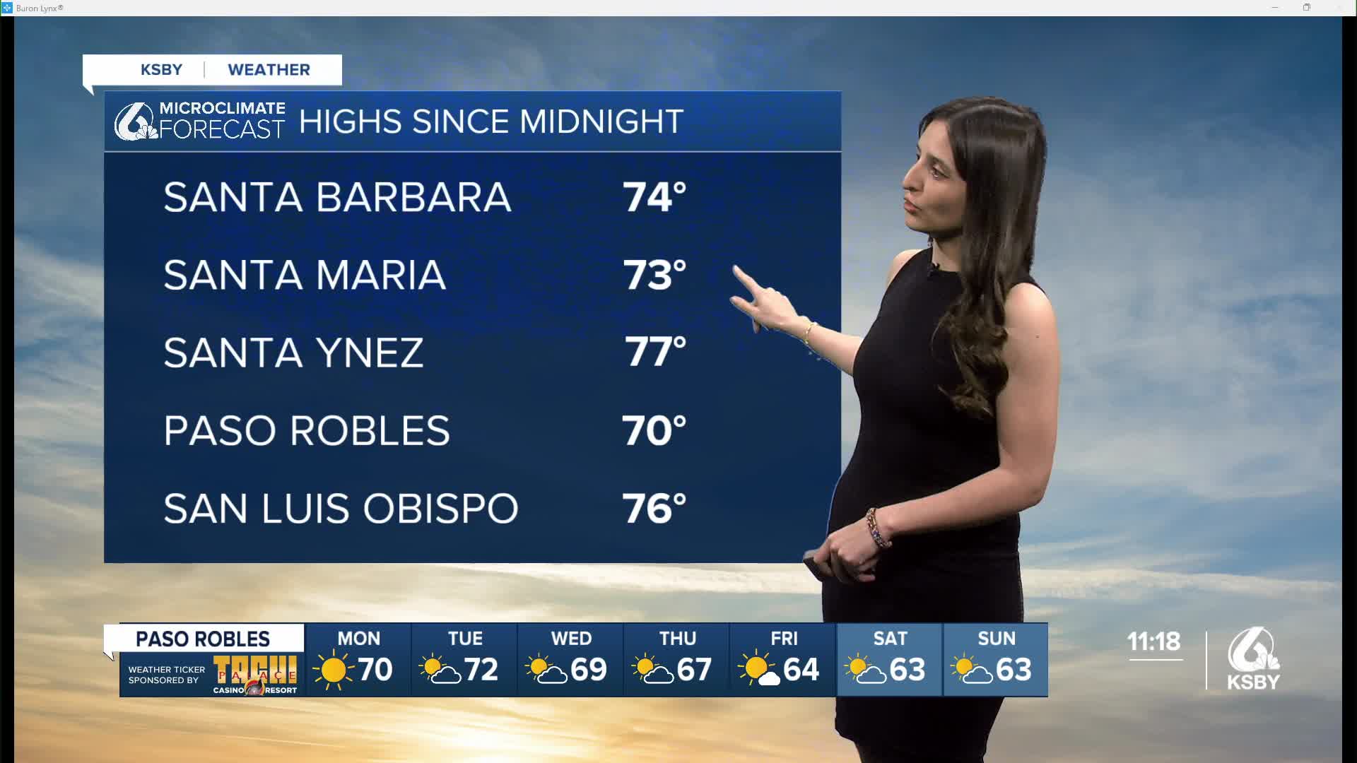


Happy Sunday, Central Coast!
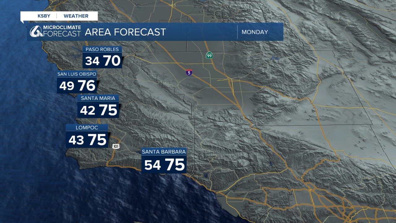
These are the temperatures you can expect on Monday. It looks like the pleasant weather we have been experiencing will continue for the first half of next week.
Things will change on Wednesday, when we'll kick off a cooling trend. That ridge of high pressure that has been bringing us those warmish temperatures will start moving away, which means we could start seeing the return of our marine layer.

Overall, most areas will see a return to those mild 60s by Wednesday.

I do want to make a note, since I did not mention this in our broadcasts. There is less than a 10 percent chance of some precipitation on Friday or Saturday (our model shows the overnight hours Wed-Thurs). The likelihood of this happening is very low, but I did want to point it out. Overall, as of now, it looks like we'll be remaining dry through the 27th with the next best chance January 28 and 29. We'll be keeping you up to date throughout the week.
Goodnight!
- Leslie Molina
