

Happy Sunday, Central Coast!
These are the temperatures we are experiencing across the region at 7:00 PM. Hard to believe we kicked off a warming trend today! A reminder that this is a slow warming trend that will stick with us Monday and Tuesday. The uptick in temperatures will be minor.
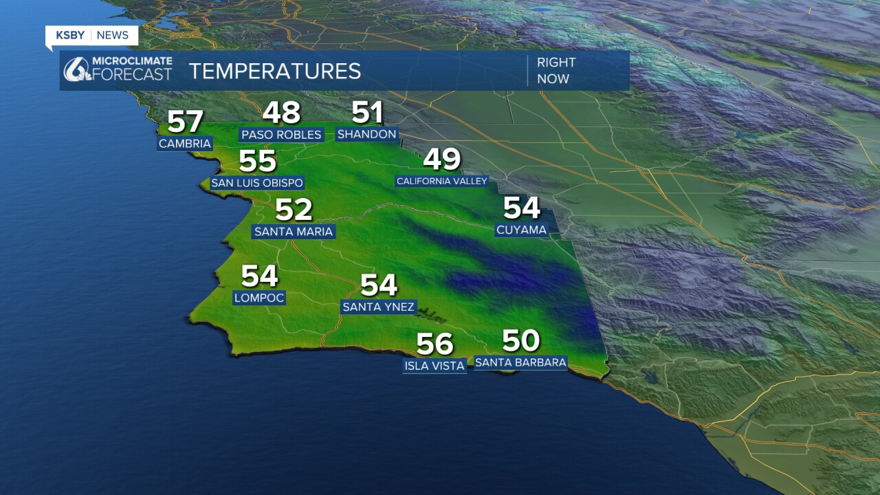
Here is a look at the temperature differences we observed at 7:00 PM today. As you can tell, most of our region is trending warmer, at least in our overnight temperatures. The bigger differences can be spotted in our interior valleys.

These are the temperatures you can expect for Monday. Mostly in the 60s, and it looks like the South Coast could break into the low 70s.

The big weather story is a historic winter storm impacting a huge portion of the United States. As of 6:00 pm Sunday, it looks to have moved to the northeast. As for us, we are just monitoring the chance for some light showers on Wednesday. There is a system impacting the Pacific Northwest, and the tail end of this system is what could bring those light showers. There is a 10 to 20 percent chance this could happen. A small chance, but good to mention.

In addition to this chance of light showers, we'll experience a minor cool down from Wednesday through Thursday. This one won't last long either.
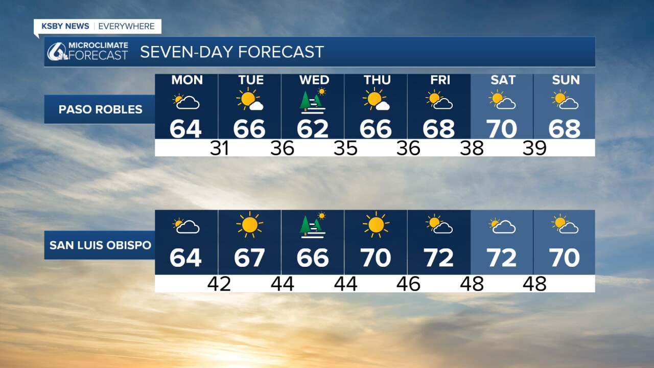
A ridge of high pressure will grow in strength, eventually bringing us warmer daytime temperatures that will stay with us into the weekend.

Enjoy the rest of your weekend!
—Leslie Molina
