



Good Tuesday evening, Central Coast!
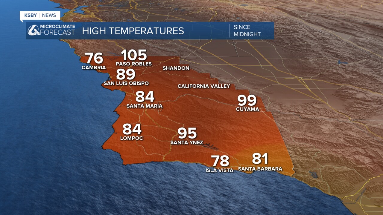
Below: The highs on Tuesday
DANGEROUS HEAT CONTINUES - WEDNESDAY WILL BE THE HOTTEST DAY
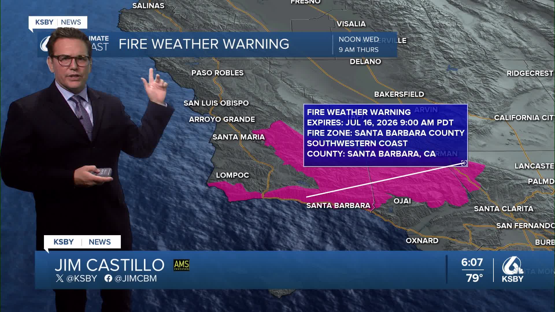
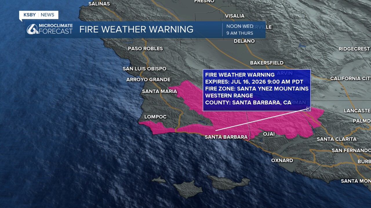
WIND CONCERNS/ A FIRE WEATHER WARNING Wednesday pm until Thursday am: Gusty northwest to north winds target southern Santa Barbara County and the interior mountains and the entire Santa Ynez range —strongest winds expected during afternoon and overnight hours N to NW gusts 35 to 50 mph, with Wednesday bringing the most significant wind activity.
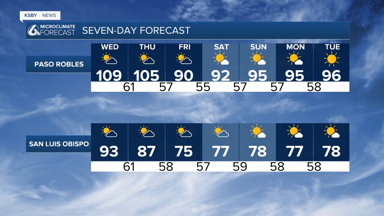
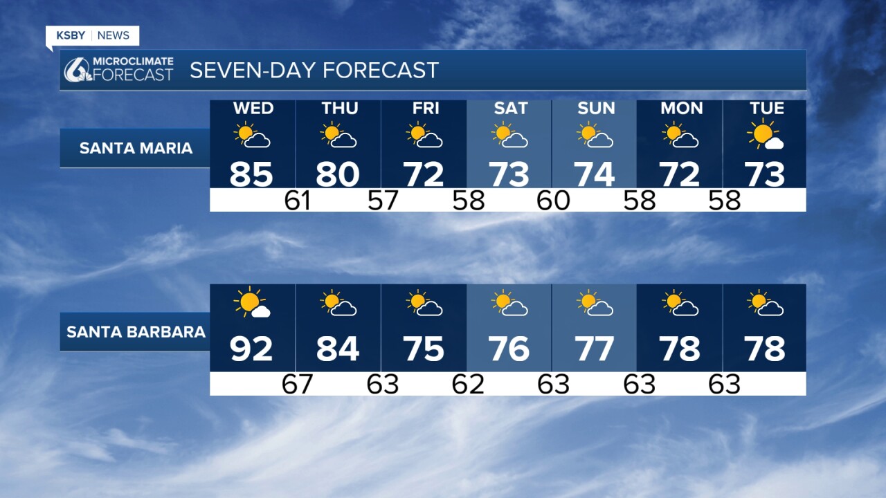
A relentless warming trend pushes temperatures to dangerous levels through Thursday across San Luis Obispo and Santa Barbara Counties. Wednesday stands out as the hottest day of the week - and potentially the hottest since March.
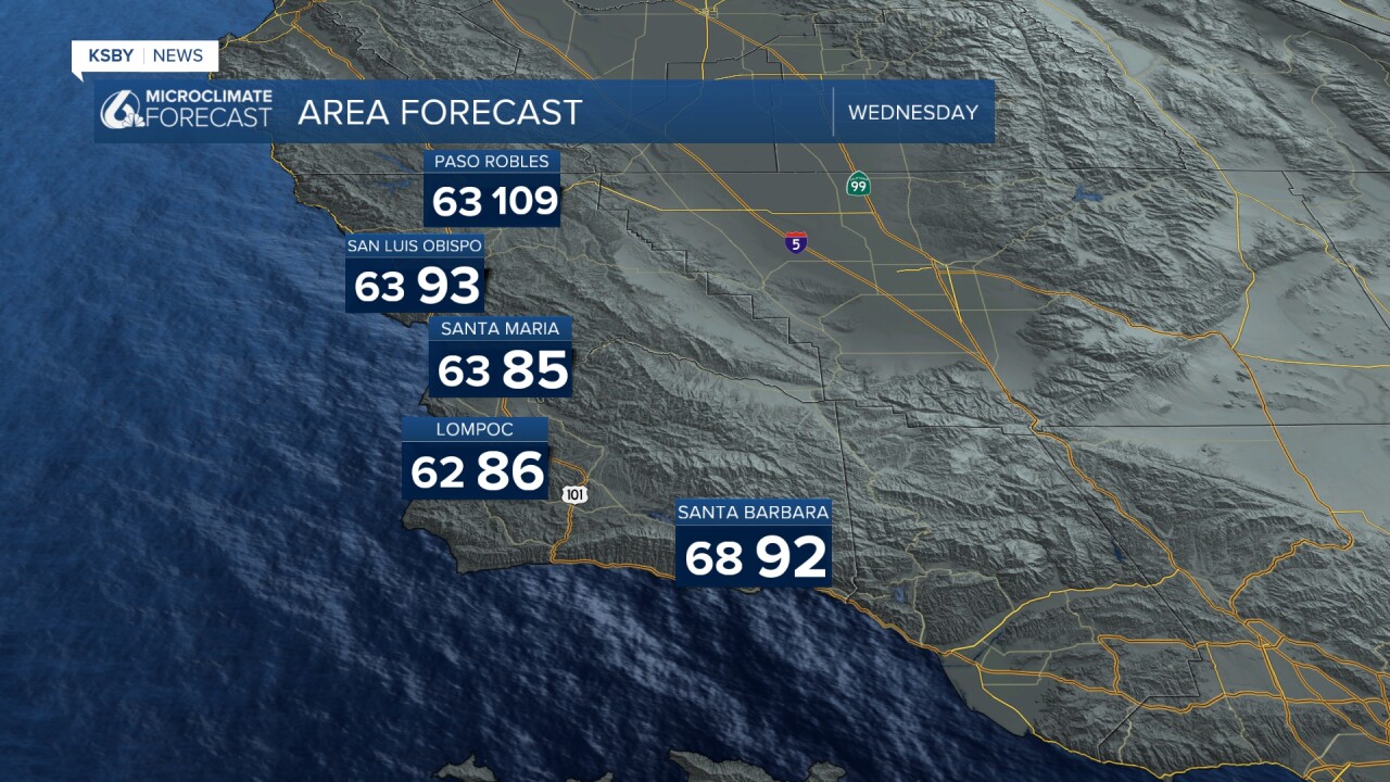
WEDNESDAY'S PEAK HEAT: Far interior valleys including Paso Robles: 105-110 degrees Downtown San Luis Obispo: Low to mid 90s
Coastal areas: Low 80s Temperatures running 10-17 degrees above normal
The forecast hinges on light offshore flow on Wednesday, which would delay the typical cooling sea breeze. If onshore gradients persist, expect temperatures a few degrees cooler than these projections.
RELIEF TIMELINE: Thursday: a few degrees of cooling, then more cooling on Friday: Additional 4-8 degrees cooler, returning near normal. Weekend and beyond: Temperatures stabilize within a few degrees of seasonal averages
ADDITIONAL NOTES: Humidity levels remain above normal in some spots, amplifying heat stress despite slowly decreasing precipitable water values. A decaying tropical storm will bring another surge of tropical moisture potentially this weekend as it tracks up the coast.
Below: A Fire Weather Warning for most of Santa Barbara County Wednesday afternoon into Thursday morning. Gusty N to NW winds 35 to 50 mph can be expected.
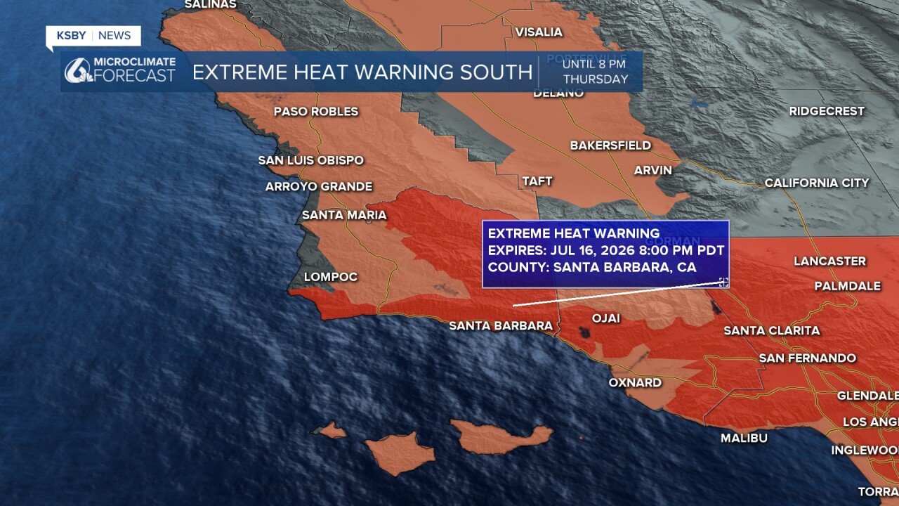
Below: An Extreme Heat Warning for most of Santa Barbara County Wednesday into early Thursday.
Below: Rip current risk is high through Wednesday.

Stay cool, Central Coast!
-Jim
