



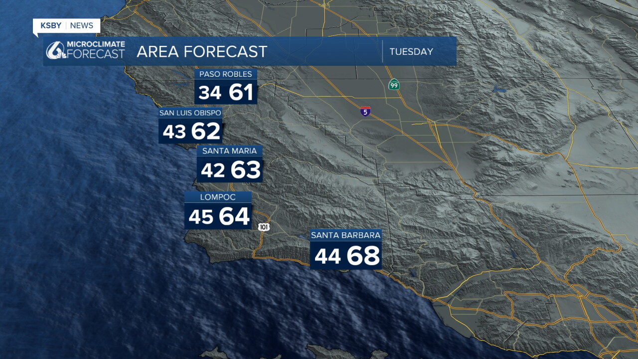
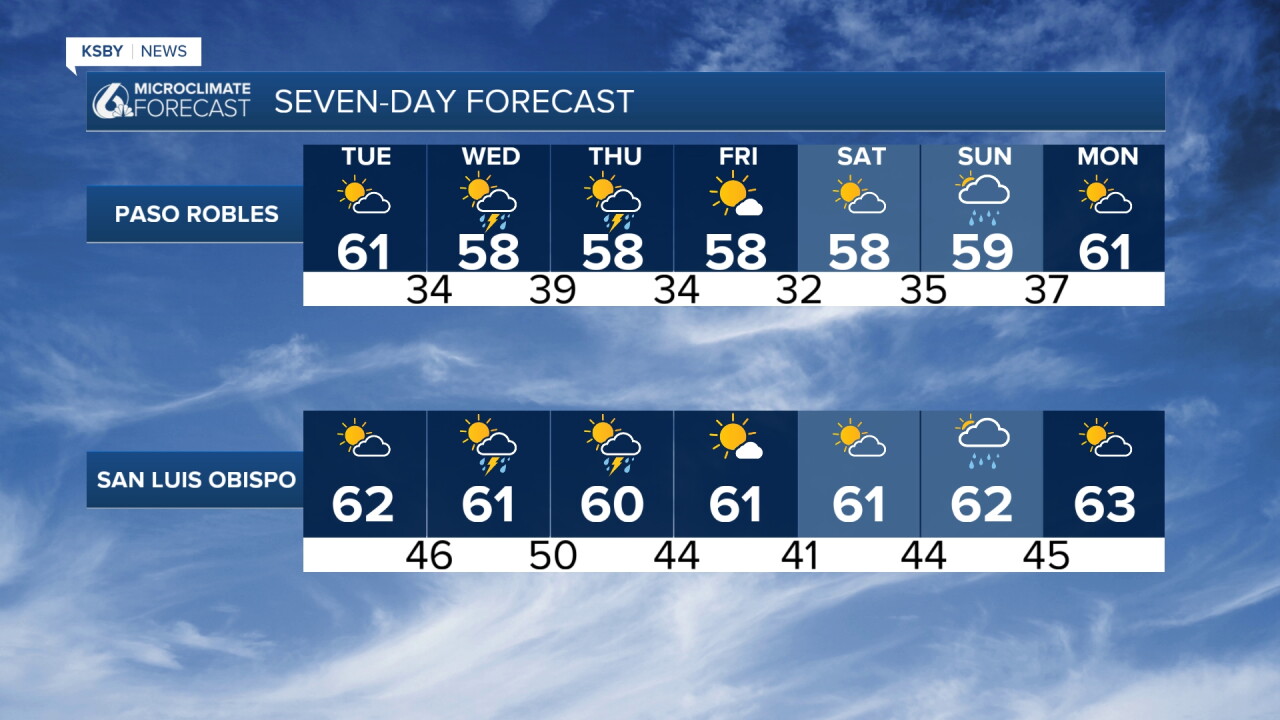
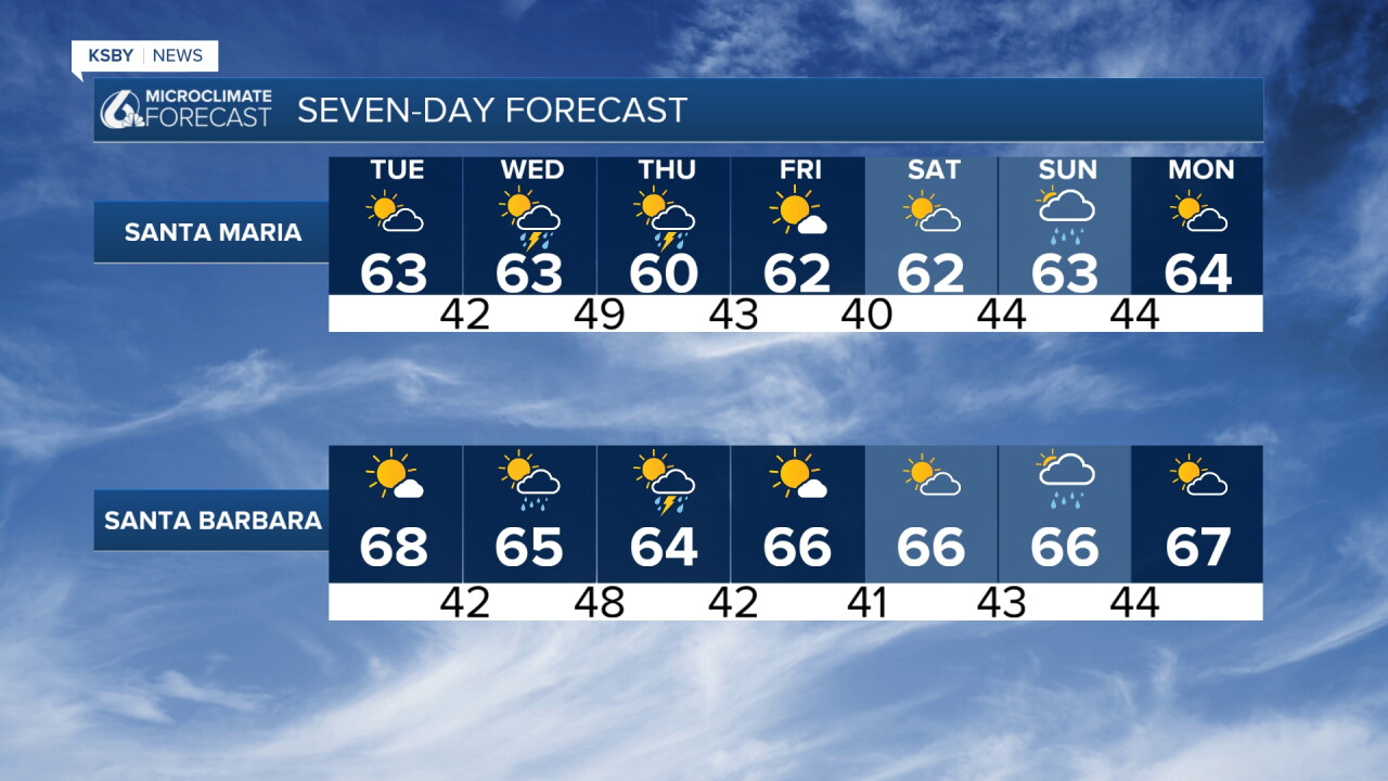
This is your Central Coast forecast from Meteorologist Jim Castillo for San Luis Obispo and Santa Barbara counties. A very active weather week is ahead, bringing frost concerns overnight Tuesday in the far inland valleys, a significant atmospheric river Wednesday into Thursday, and hazardous coastal surf. Here is what you need to know to stay prepared:
Monday's rainfall totals were low, ranging from .24" in Cambria, .10" in Paso Robles to Atascadero, San Luis Obispo .07", Oceano .01" and near Santa Barbara, .03" in Santa Maria.
Monday Night through Wednesday Morning:
Following Monday's weak system, gusty northwest-to-north winds will develop across the interior mountains and southwest Santa Barbara County Monday night into Tuesday morning with a wind advisory until 9 am with NW wind 15-30 gusts to 45 mph. Temperatures will turn noticeably cooler on Tuesday and stay chilly into Wednesday morning, bringing frost and freeze concerns to far interior valleys and the mainly wind-sheltered areas.
Wednesday Afternoon through Thursday: Significant Midweek Storm
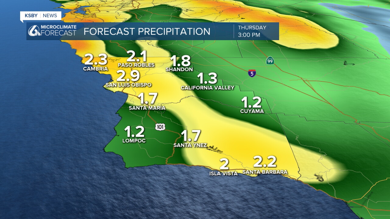
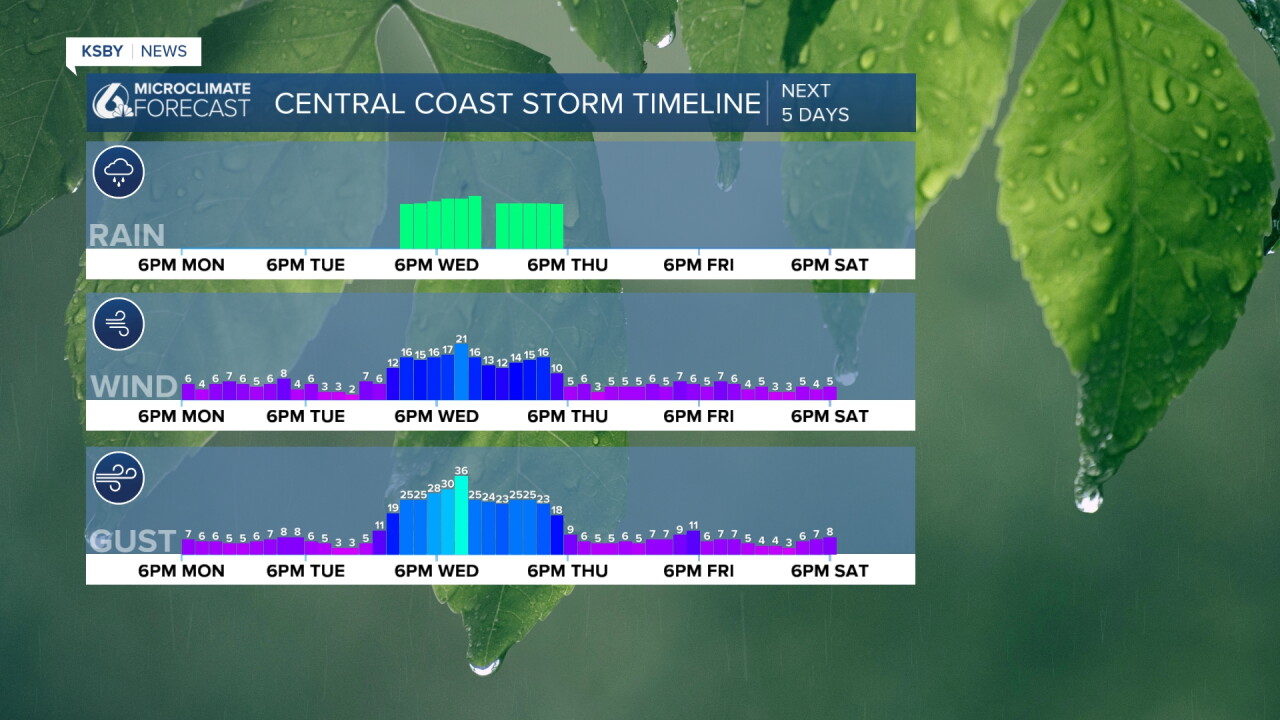
Widespread, moderate-to-heavy rain arrives as early as Wednesday afternoon for the Central Coast. Driven by an atmospheric river ahead of a progressive cold front, widespread rainfall totals of 1 to 3 inches are expected across coastal and valley communities. Orographic lift along south- and west-facing slopes of the Santa Lucia Mountains, Santa Ynez Mountains, and Los Padres National Forest will push totals to 2 to 5 inches.
Flooding and Debris Risks: Watch for minor-to-moderate urban and small-stream flooding, rapid rises in normally dry riverbeds, and debris flows near recent burn scars, most likely within an intense 8-hour window starting Wednesday afternoon.
Thunderstorms possible: There is a 10 to 20 percent chance of thunderstorms capable of cloud-to-ground lightning, downpours, and gusty winds.
Damaging Winds mainly Wednesday night: Widespread peak wind gusts of 30 to 50 mph are projected, reaching 40 to 60 mph across the mountains and interior foothills, which may down trees in rain-loosened soil and cause power outages.
Friday through Sunday: Brief Dry Break and Weekend Outlook
Dry weather returns on Friday with rebounding temperatures and light offshore flow before a weakening front brings a low-confidence chance for light showers back to the Central Coast around Sunday.
Beach and Marine Hazards
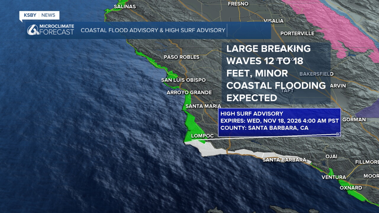
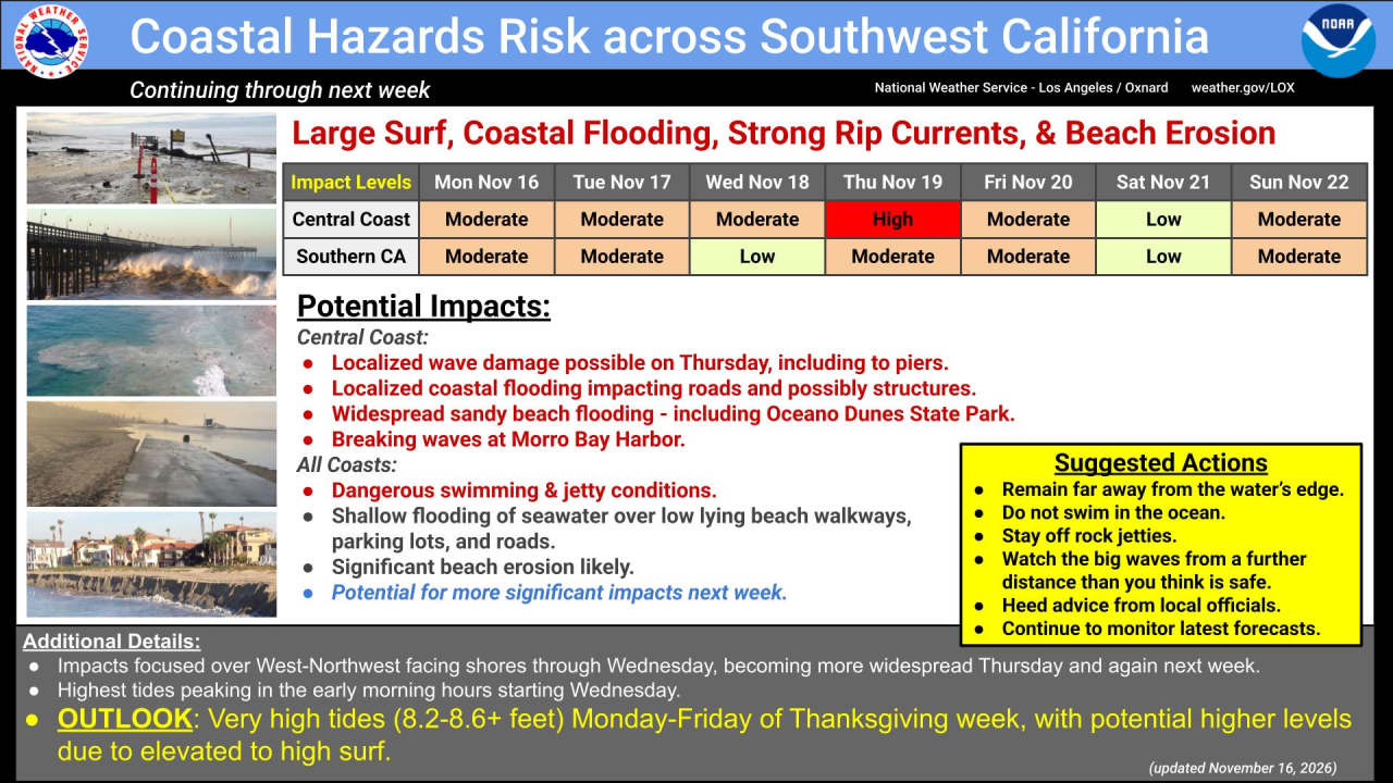
A High Surf Advisory remains in effect through Tuesday afternoon and will likely be extended through the week as west-northwest swells generate 10-to-18-foot surf, potentially returning back to Warning levels Wednesday and Thursday. Dangerous rip currents, sneaker waves, and shallow morning high-tide overflows into low-lying areas are expected along west- and northwest-facing beaches. Mariners face Small Craft Advisory conditions through midweek, potential Gale-force gusts Wednesday night through Thursday night, and dangerous breaking waves at the Morro Bay harbor entrance.
High KING tides will likely be over 8 feet during Thanksgiving week!!!!!
Stay weather-aware and secure loose outdoor items before Wednesday.
-Jim
