



Good Wednesday evening from Meteorologist Jim Castillo
Here is your Central Coast weather forecast for all of San Luis Obispo & Santa Barbara Counties
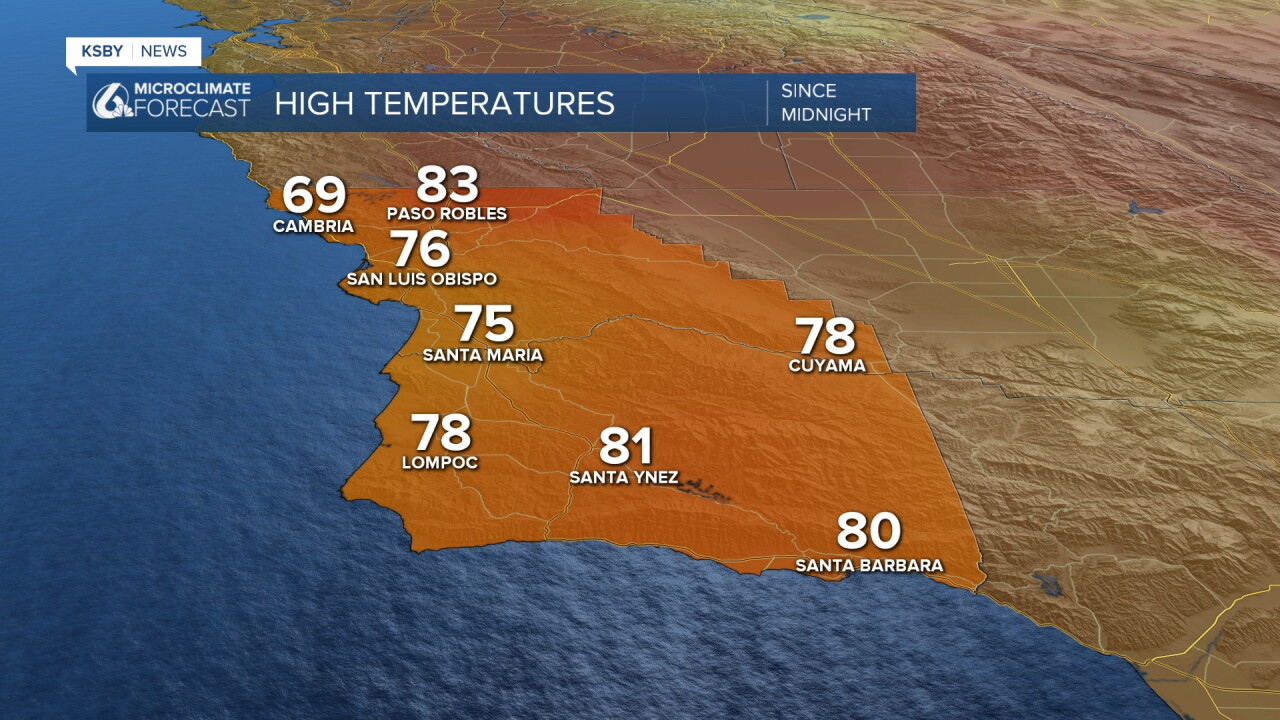
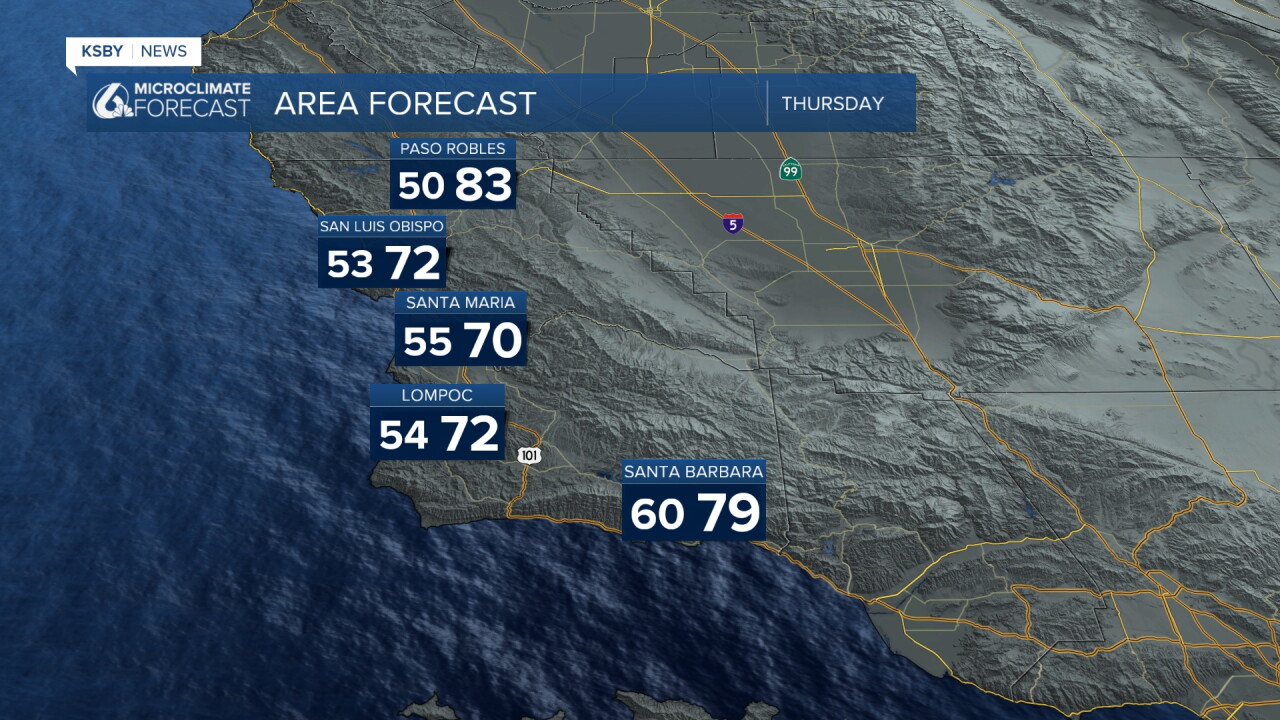
Below: The highs on Wednesday are below average again with a cool trough of low pressure along the West Coast.
Tonight Through Friday Night: Wildfire smoke will continue in the air as two large fires continue up in Monterey County. Air quality will continue poor at times and in pockets.
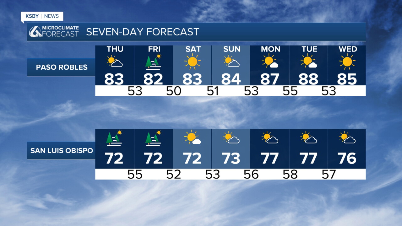
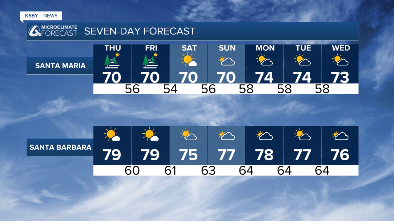
A persistent stagnant weather pattern will dominate the Central Coast through Friday, keeping temperatures below seasonal normals. The marine layer will return more widely to coastal areas and even coastal valleys of San Luis Obispo County.
Sundowner Winds:
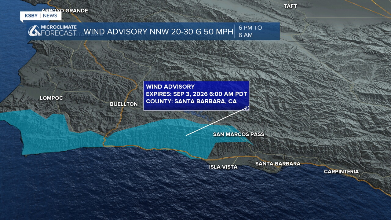
Wind Advisories are in effect for the western half of the Santa Ynez Mountains tonight until 6 am on Thursday. These northerly gradients will weaken Thursday and Friday nights, reducing the likelihood of advisory-level Sundowner winds in southern Santa Barbara County. The Los Padres National Forest areas in both counties should monitor conditions closely. NNW 20 to 30 mph with gusts to 50 mph overnight.
A slight chance of light showers may develop across Ventura County by Saturday evening, though any rainfall amounts are expected to be minimal. Temperatures will rise a few degrees with increasing humidity, creating more tropical-like conditions. Morning coastal stratus and fog are likely before partly cloudy to mostly clear skies develop.
Labor Day Weekend Outlook:
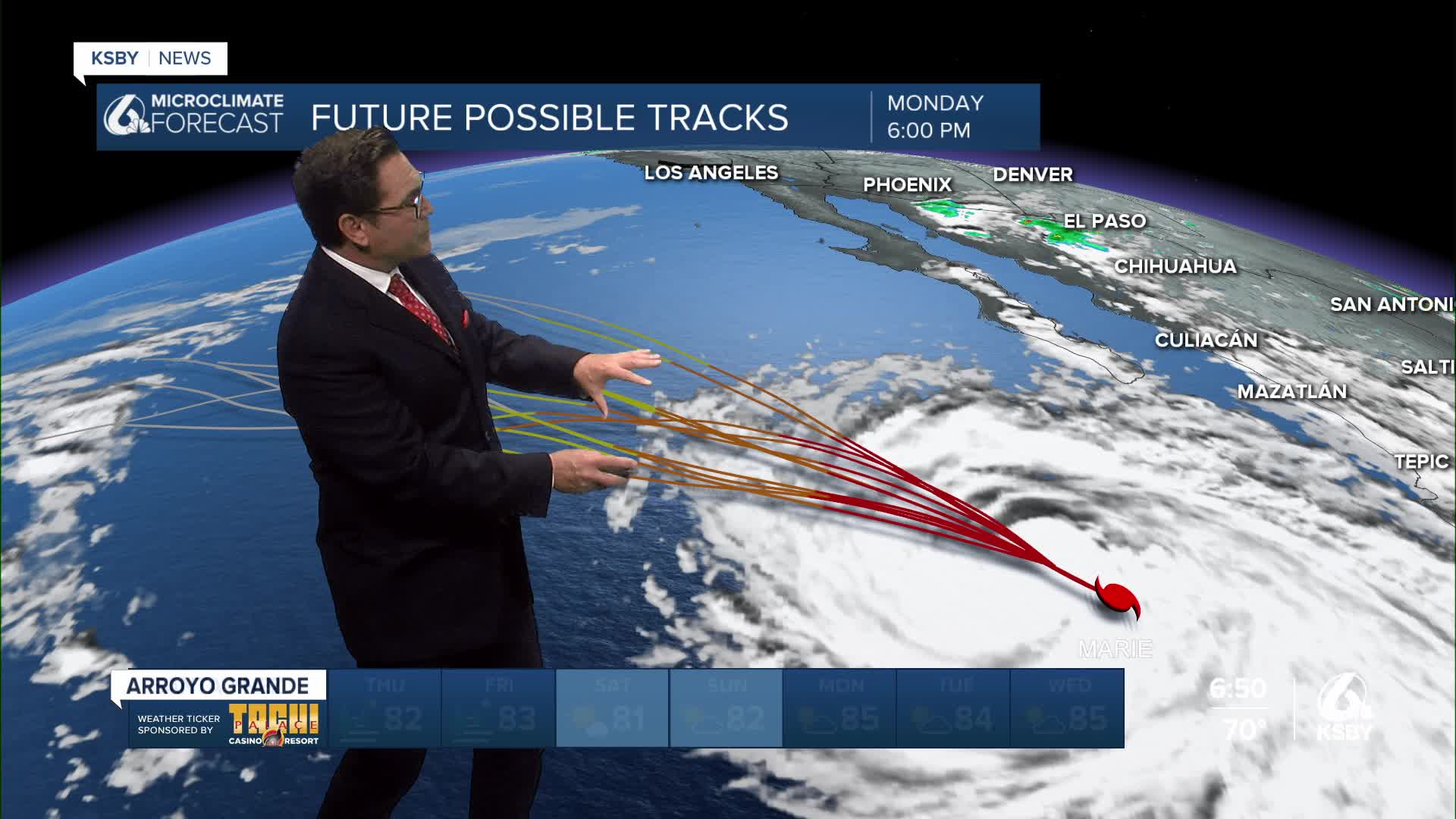
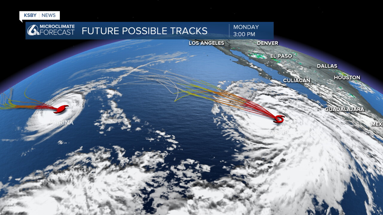
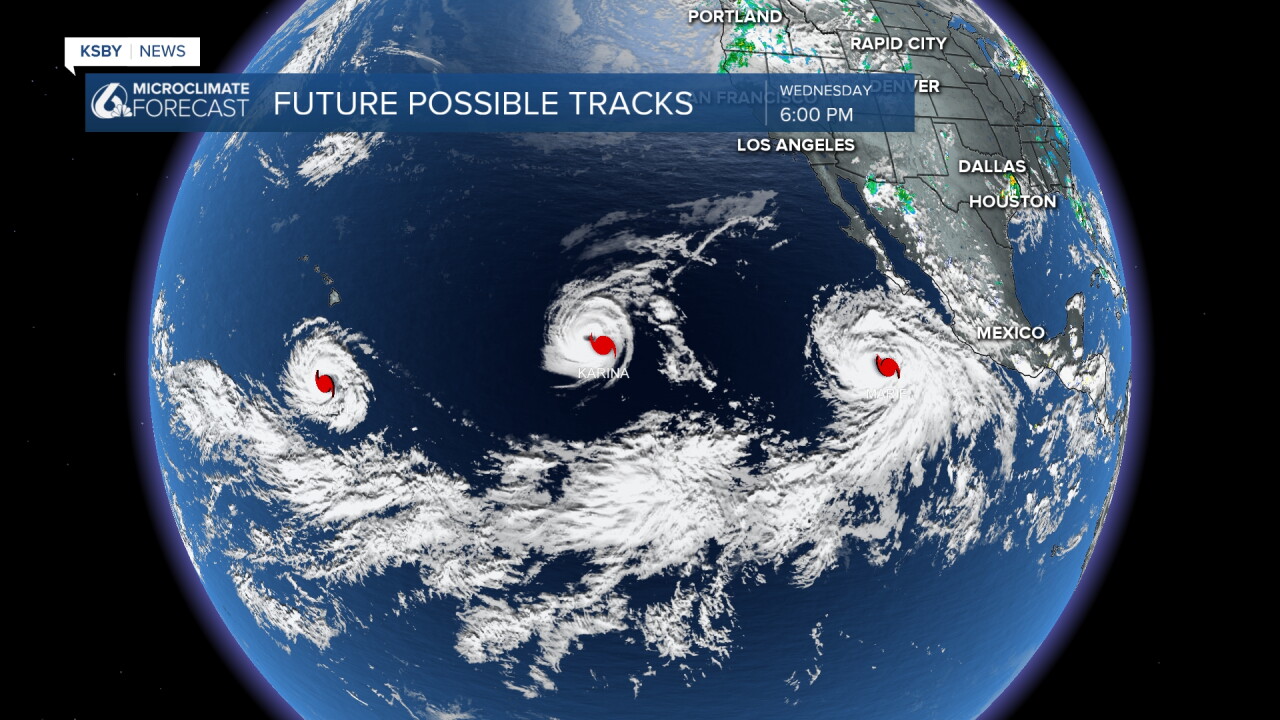
Multiple scenarios remain possible for the holiday weekend, ranging from benign conditions to offshore wind gusts and spotty rain chances beginning Sunday. Current National Hurricane Center tracking shows Marie moving west and northwest far off the coast, keeping direct tropical system impacts away from the Central Coast. However, any rain chances look slim to none from Sunday afternoon through Tuesday across the region.
Mid-level moisture: The mid- and upper-level moisture shield could graze southwest California, though the bulk of any meaningful rainfall should stay suppressed or may shift westward as our west coast mid-latitude trough interacts with the region. We are in the robust El Niño state currently taking shape, and this continues to pump ample heat and moisture into the broader marine environment, keeping our long-range forecasting on high alert.
Below: The latest ensemble weather computer runs and consensus tracks continue to keep Marie on a safe west-northwestward trajectory well out over the open waters of the eastern Pacific Ocean. Long-period southerly swell generated by Marie's circulation will still likely propagate toward the Southern and Central Coasts, elevating the risk of high surf, minor coastal flooding, and increased rip current risk over the holiday weekend.
Have a great night, Central Coast!
-Jim
