


Good Monday evening,
Here's your Central Coast weather forecast for San Luis Obispo and Santa Barbara Counties:
MARINE LAYER AND COASTAL CONDITIONS Low clouds and fog will continue to blanket most coastal areas and some coastal valleys through the end of the week during overnight and morning hours. The marine layer depth will gradually decrease as we progress through the week, with clearing expected by late morning each day along the coast.
WIND ALERTS AND TIMING Gusty sundowner winds are forecast for western Santa Barbara County this evening and Tuesday. These downslope winds typically accelerate through mountain passes and canyons. Additionally, winds will intensify along the Central Coast Tuesday evening and continue overnight into Wednesday. Wind Advisories remain active for northwest winds across southwestern Santa Barbara County tonight through early Tuesday morning.
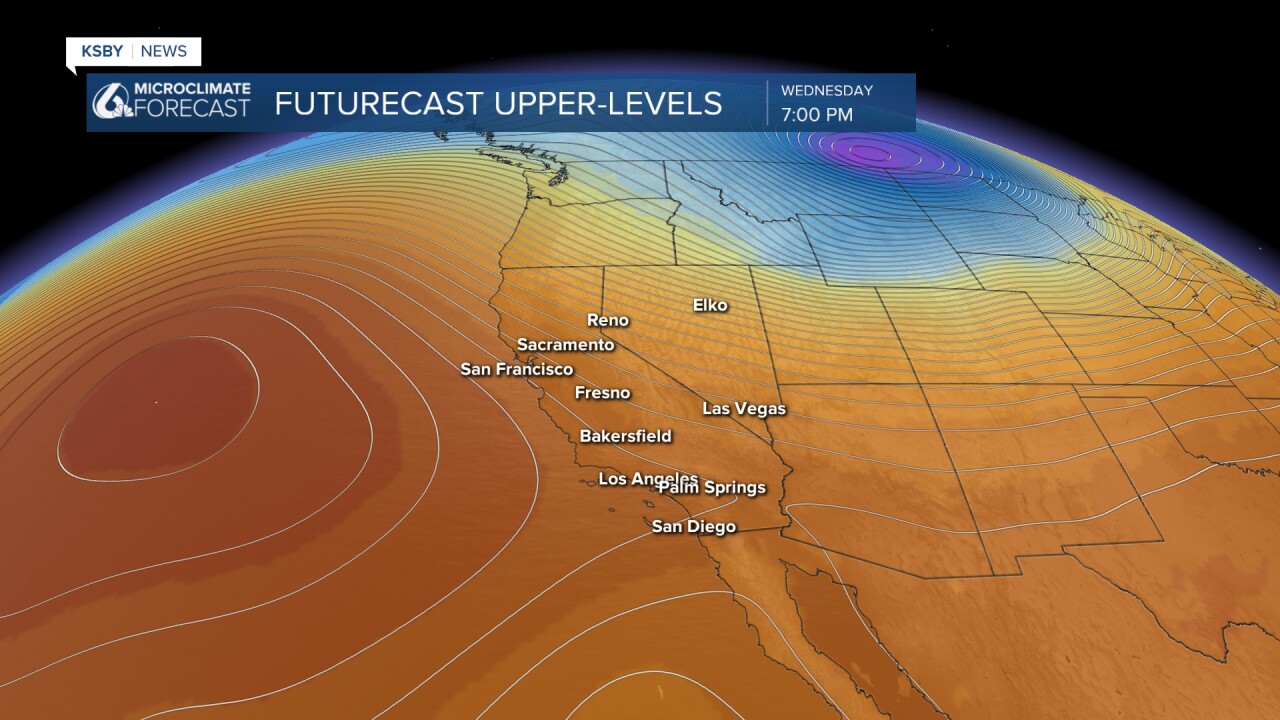
TEMPERATURE TREND A significant warming pattern begins Tuesday as an upper-level trough moves east and high pressure builds offshore. Coastal valleys and interior locations will see the most dramatic temperature increases. By Wednesday, the onshore pressure gradient weakens substantially, reducing marine cooling influences even at the coast. The warmest coastal valleys could reach the mid to upper 90s by Wednesday.
SANTA LUCIA AND SANTA YNEZ MOUNTAINS Mountain areas within Los Padres National Forest will experience the warming trend with temperatures running 5 to 10 degrees above seasonal averages. The higher terrain may see occasional afternoon cloud development as atmospheric patterns shift.
EXTENDED OUTLOOK (Friday through Monday) Persistent high pressure will maintain elevated temperatures through the weekend, keeping readings 5 to 10 degrees above normal. Marine layer clouds will reform each morning but remain primarily confined to beaches and coastal plains with limited inland penetration. A slight chance of thunderstorm activity may develop over mountain areas Friday and Saturday as monsoonal moisture approaches from the southeast.
MARINE INFLUENCES Moderate onshore flow continues through Tuesday, providing some coastal cooling. However, Wednesday marks a notable shift as marine influences diminish significantly, allowing interior warming to extend closer to the coastline.
This pattern represents a typical late-summer transition from marine-dominated weather to more continental influences as high pressure strengthens offshore.


Have a great night, Central Coast!
-Jim
