

Happy Sunday, Central Coast!
Let's start today's forecast with the advisories in place for our region, because there are a few. The high surf advisory I mentioned yesterday has been extended from Monday until Tuesday. Waves could reach up to 13 feet in height and could be accompanied by dangerous rip currents.

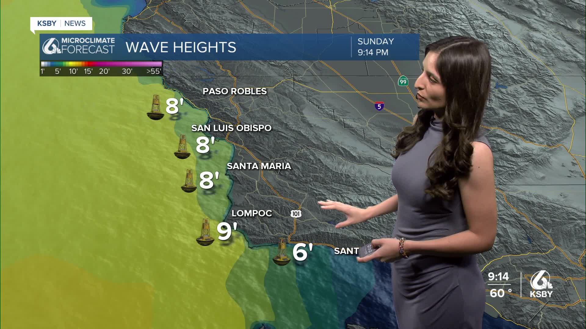
Here is a look at some of the wave heights we have recorded as of 3:22 PM Sunday. The wave heights have increased compared to what we recorded on Saturday, around the same time. We are now seeing an average of 9 to 10 feet. The best advice during this time is to avoid getting in the water because there is an increased risk of drowning.

There is also a wind advisory in place for the south coast, which I mentioned would be extended until Monday. This area could experience wind gusts up to 50 mph. These winds are expected to be stronger this evening and into Monday morning.

Overall, this weekend we experienced a slight drop in temperatures. The Central Coast will start to see a slight uptick in temperatures as we begin our work week.

The warmest days for this upcoming week will be Wednesday and Thursday. There looks to be no rain chances in our near future.

Enjoy your evening, Central Coast!
— Leslie Molina
_____________________________________________________________________________________________________________________
¡Feliz Domingo, Costa Central!
Empezamos el día con varias advertencias para nuestra región. La primera advertencia es de oleaje fuerte para los condados de San Luis Obispo y Santa Bárbara (las zonas pintadas de un color morado oscuro). Este advertencia incluye las playas de Pismo y Ávila.

La razón detrás de esta advertencia son condiciones marinas peligrosas. Este domingo hemos observado olas de 9 a 10 pies de altura. Estas condiciones no son ideales para nadar, ya que existe un alto riesgo de ahogarse.

Además, hay una advertencia de viento para la costa sur (zona pintada de azul). Esta región experimentará ráfagas de hasta 50 mph y la advertencia expirará el lunes a las 6 de la mañana.

Continuaremos observando temperaturas más frías en nuestra región el lunes. La razón detrás de estas temperaturas es un frente frío que llegó al norte de California el viernes, trayendo lluvias a esa región y vientos para nosotros en la Costa Central.

Este sistema se desplazará y será reemplazado por un sistema de alta presión que traerá temperaturas más cálidas a partir del martes.

Los días más calurosos para la Costa Central serán martes y jueves.

¡Buenas Noches!
— Leslie Molina
