Forecast update from meteorologist Dave Hovde 10:18am
Dave Hovde-KSBY
From meteorologist Dave Hovde: A FLASH FLOOD WATCH has been issued for parts of SB and Ventura county for potential afternoon storms which could cause high rain rates and localized flooding. Here is…
Thunderstorms are expected to develop this afternoon over the northern Ventura and Santa Barbara County mountains this afternoon and possibly into the Cuyama Valley as well. The storms will be very slow moving leading to a chance of flash flooding with rain rates as high as 1 to 2 inches per hour. The area of greatest concern is Lockwood Valley in northern Ventura County but the Cuyama area could also see activity.
Frequent lightning strikes are possible as well.
From prior forecast:
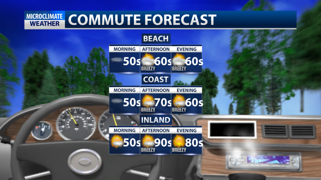
Another foggy morning is on tap for the Central Coast, primarily impacting the coastal valleys and beaches. While the coastal valleys will see sunshine by early afternoon, the marine layer could be stubborn to clear and result in a typical “June Gloom” day for the beaches. The interior valleys are a different story. Daytime highs for the inland regions will range from the upper 80s to mid-90s.

A trough of low pressure will dig into the Pacific Northwest Thursday, which will result in a cooldown that will bring inland temperatures back to the 80s through the start of the weekend.

Thunderstorm potential remains over the interior valleys, mountains, and foothills Wednesday. There’s a 20% chance that California Valley, Shandon, and Cuyama could see some of this activity from 11 a.m. to 11 p.m.
East of Paso Robles late Sunday afternoon….. before the lightning. We kinda felt like storm chasers. #beonksby
Posted by Rick Evans on Monday, June 3, 2019

