


MADRE FIRE
- 52,592 acres
- 10% containment
- Highway 166 closed between Highway 101 and New Cuyama
UPDATE (7:39 p.m.) - 52,952 acres now burned as of Thursday night according to CAL FIRE then downgraded back to 52,592 a short time later.
UPDATE (6:22 p.m.) - The Madre Fire is now 10% contained, according to CAL FIRE.
___
UPDATE (5:24 p.m.) - Areas under evacuation orders and warnings in San Luis Obispo County have been updated to the following:
Evacuation Orders: Zones LPF-017, SLC-226, SLC-240, SLC-263 SLC-264, SLC-265, SLC-298, SLC-299, SLC-300, SLC-312, SLC-313, SLC-337, SLC-338, SLC-339, SLC-358.
Evacuation Warnings: Zones SLC-225, SLC-239, SLC-266, SLC-301, SLC-359, SLC-365, SLC-366, and SLC-367
___
UPDATE (3:45 p.m.) - CAL FIRE reports the Madre Fire has now burned 52,593 acres. Containment remains at 10%.
WATCH: Video from day 2 of the Madre Fire
___
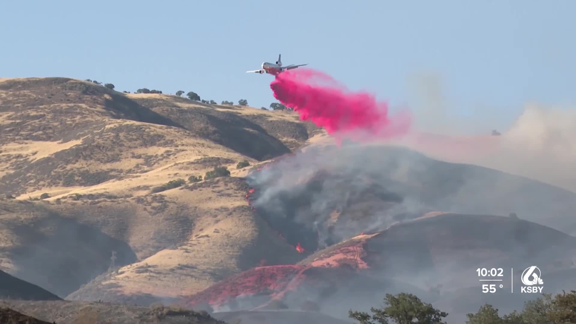
(12:11 p.m.) - Firefighters face challenges from wind and steep terrain as they battle the state’s largest wildfire, burning in San Luis Obispo County.
The Madre Fire broke out Wednesday afternoon along Highway 166 between Santa Maria and Cuyama and quickly exploded in size, burning close to 10,000 acres by 6 p.m.
Santa Barbara County Fire Captain Scott Safechuck says the combination of light, flashy fuels and windy weather contributed to the fire’s rapid growth.
WATCH: What caused the Madre Fire's explosive growth?
“If you imagine that wind pushing the fire along those tall annual grasses up the slope, and fire wants to go uphill faster than it wants to go downhill, so it was in this alignment and allowed it just to keep pushing into steeper and more difficult terrain to access with our ground personnel,” Capt. Safechuck explained.
As of Thursday morning, the fire has burned 35,530 acres and is just 5% contained. Fire officials say it is burning east-northeast into the Carrizo Plain National Monument. Safechuck says 11,500 acres of the national monument have already burned.
WATCH: Timelapse of the Madre Fire from remote camera atop McKittrick Summit
More than 300 personnel from multiple firefighting agencies are assigned to the blaze, working on the ground and from the air to control the fire.
Safechuck says that because the fire is burning in such a remote area, accessibility will continue to be an issue, especially along the north flank of the fire.
“It’s really in steep terrain,” he said. “It’s going to be hot out there and we have to cut line to get in there with our hand crews and then start working along that fire line, but we’re working in coordination with our air resources so we can cool down that fire edge, or perimeter, to get our resources in there, but we just have to plug away and keep at it.”
Despite the remote location of the fire, there are reported to be 50 structures threatened, and Safechuck says more than 200 people are under evacuation orders and warnings in both San Luis Obispo and Santa Barbara counties.
San Luis Obispo County Evacuation Orders:
- Zones LPF- 017, SLC-226, SLC-264, SLC-265, SLC-299, SLC-312, SLC-337 and SLC-338
San Luis Obispo County Evacuation Warnings:
- Zones SLC-263, SLC-298, SLC-300, SLC-313, SLC-339, SLC-358
Santa Barbara County Evacuation Warning:
- Area east of Rock Front, west of Cottonwood Canyon Rd., and south of Highway 166
An evacuation center has been set up at the California Valley Community Services District located at 13080 Soda Lake Road.
The cause of the fire is under investigation.

