


Good Friday evening, Central Coast!
He's the weather outlook for San Luis Obispo and Santa Barbara Counties:
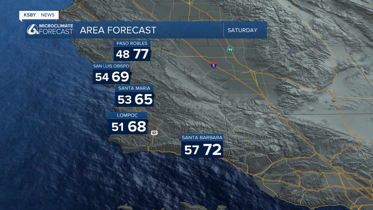
Expect a weekend Cooling Trend Ahead for the entire area!
A notable cooling trend is developing across San Luis Obispo and Santa Barbara Counties this weekend, with Sunday bringing the most significant temperature drop. Inland areas will see the biggest change, with coastal zones experiencing more moderate cooling.
Saturday's Forecast: Expect a couple of degrees of cooling compared to recent days. Marine layer clouds and fog will continue their nightly pattern, pushing inland through the coastal valleys to depths likely around 2,500 feet before burning off during the day. Partly cloudy skies will develop as high-level clouds increase. Gusty southwesterly winds will persist across interior sections during the afternoon and evening hours.
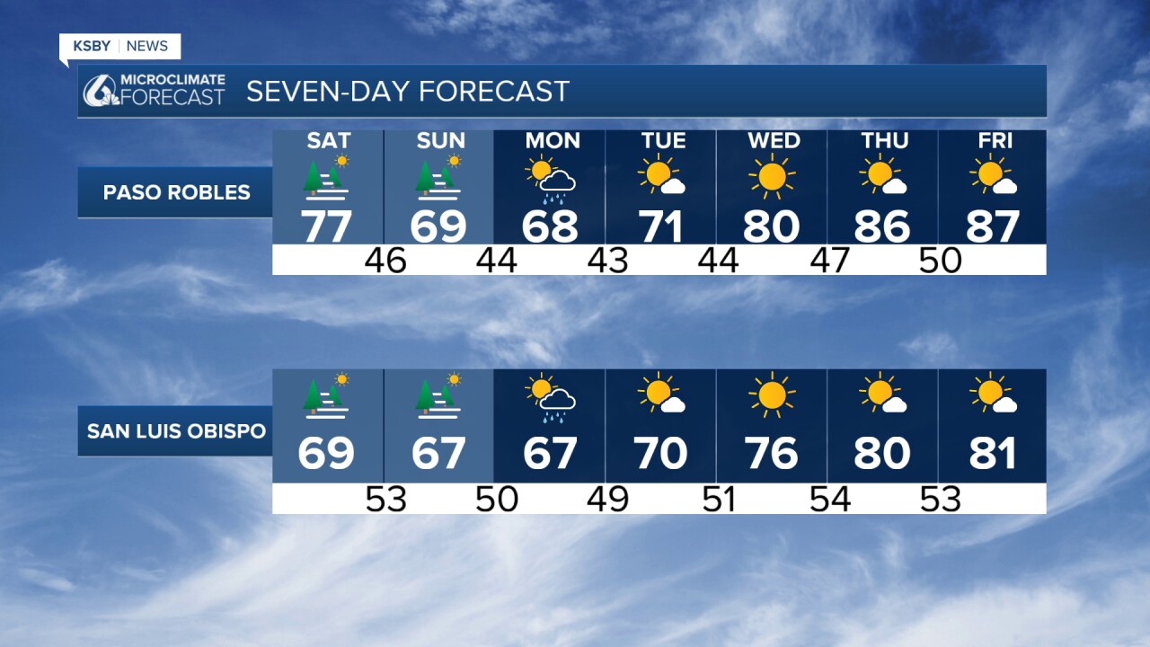
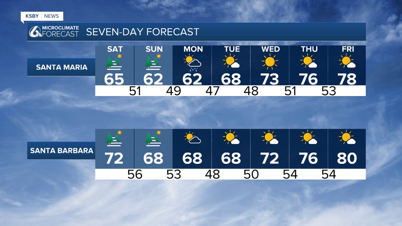
Sunday's Dramatic Cooling Much more significant cooling arrives Sunday, with temperatures dropping to the upper 50s along the coast and 60s for inland valleys. This represents a substantial change from recent conditions. The strongest winds of the weekend are expected on Sunday, with gusty southwesterly flows continuing, especially across the Santa Lucia Mountains, Santa Ynez Mountains, and interior sections of Los Padres National Forest.
A cut-off low-pressure system will move into California by Monday. Light rain showers or drizzle are possible late Sunday into Monday morning, though amounts will be minimal for most areas. The northwest corner of San Luis Obispo County has the best chance for accumulation, potentially seeing 0.10 to 0.20 inches in a worst-case scenario. Most other areas would see only a few hundredths of an inch, and some areas may not record measurable rainfall.
The weather pattern shifts dramatically starting Wednesday as high pressure builds overhead. Dry conditions return with a warming trend that will push temperatures back into the mid-70s to mid to upper 80s by Thursday, around Paso Robles. The marine layer will continue its typical night and morning cycle throughout the period.

Enjoy the weekend, Central Coast!
-Jim
