



Here's your Central Coast weather forecast from Meteorologist Jim Castillo for San Luis Obispo and Santa Barbara Counties
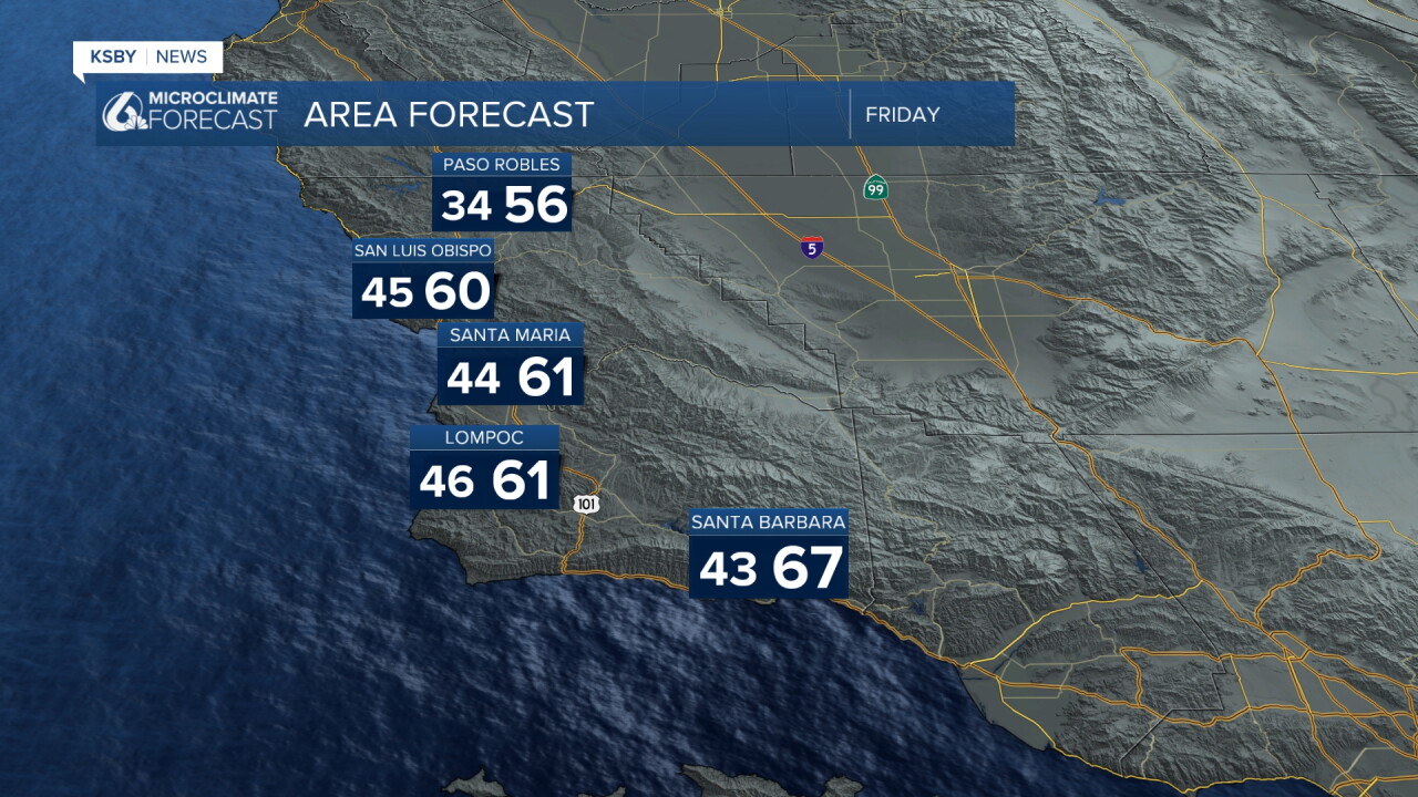
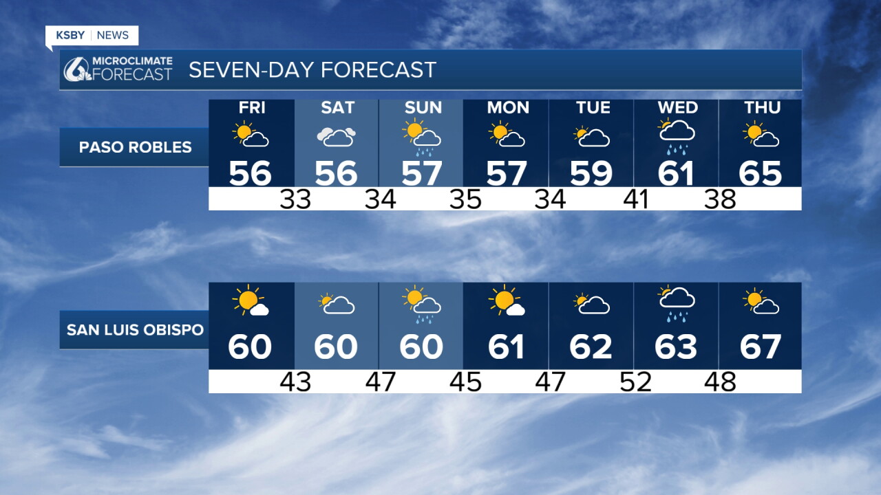
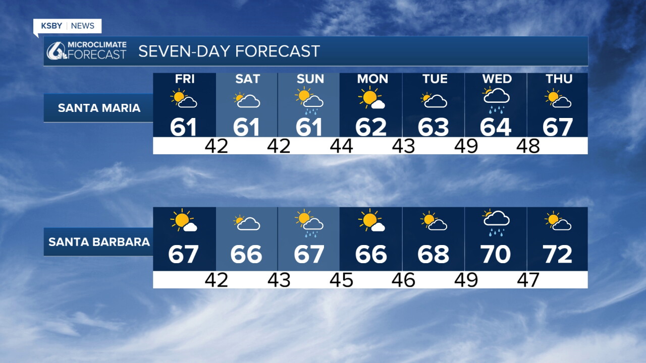
Scattered showers linger through Thursday night; we clear out by morning, and it's a chilly start on Friday. Expect dry, cool weather to return Friday and Saturday for San Luis Obispo County, Santa Barbara County, the Santa Lucia Mountains, the Santa Ynez Mountains, and the portions of Los Padres National Forest within those two counties.
Highs mostly in the fifties and sixties and chilly overnight lows, including possible sub-freezing temperatures in interior San Luis Obispo County and sheltered basins.
Light northeast winds up to twenty to thirty miles per hour develop over the weekend in mountain passes and canyons, with light rain possible Sunday night into Monday morning.
Monday afternoon and Tuesday stay dry and gradually warmer; a weak system brings rain potential Wednesday. Thanksgiving looks dry with highs reaching the seventies.
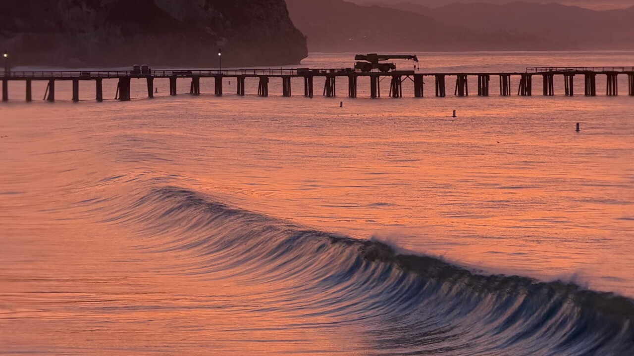
Dangerous ocean conditions, high surf, and rip currents continue into Friday, while potentially record-breaking high tides and building swells next week raise moderate to significant coastal flooding concerns Tuesday through Thanksgiving.
Have a great night, Central Coast!
-Jim
